
New Road Lime Kilns
The New Road Lime Kilns (often called the Top Kilns) represent the peak of industrial innovation at Bugsworth Basin, showcasing the most technologically advanced phase of lime production across the entire site.
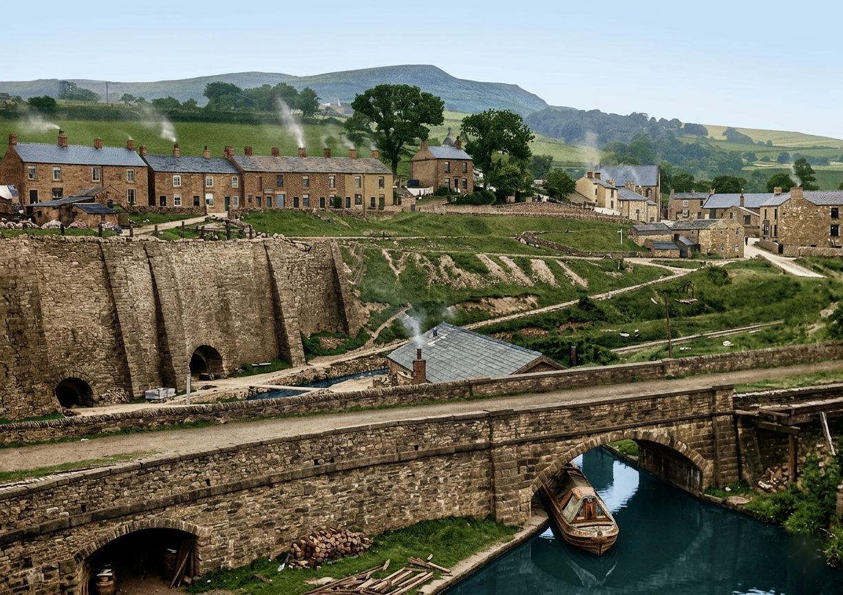
Historical image New Road Lime Kilns battery. (Click to expand)
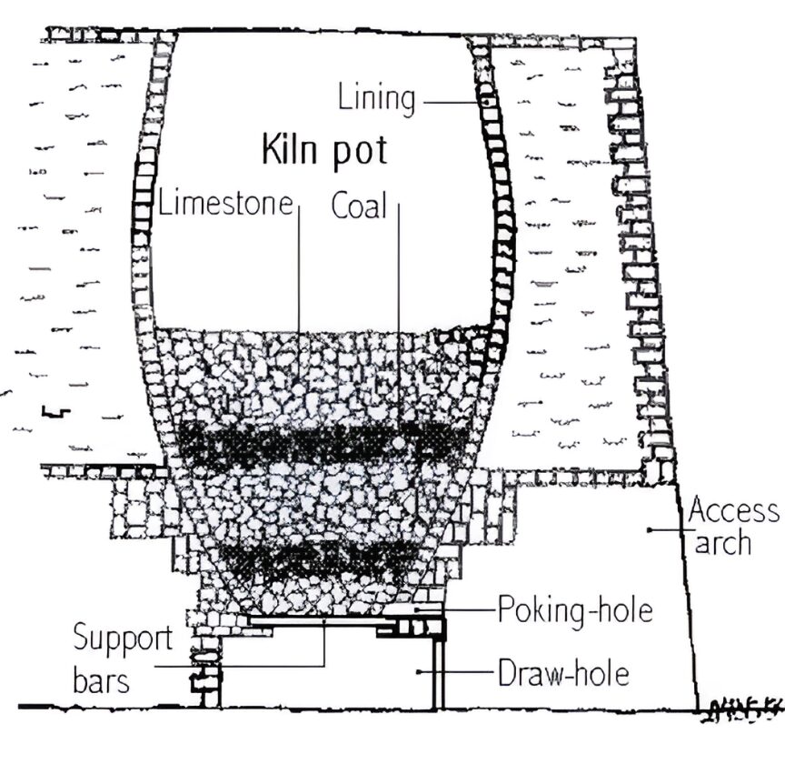
Cross-section blueprint illustrating gravity-fed charging and drawing loops. (Click to expand)
A Massive Battery of Eight Kilns
While Bugsworth Basin originally hosted four separate kiln blocks totalling 19 individual shafts, this massive New Road structure was a dedicated battery of eight kilns lining the north side of the interchange. Rebuilt and expanded in stages between 1808 and 1827, this long construction window saw the battery grow into a massive operation that would keep burning for roughly a century. Engineers built these newer shafts significantly taller than the older "Navigation Kilns" to improve the internal thermal updraft. This extra height ensured a much cleaner burn, while giving the finished quicklime plenty of time to cool down safely before the lads had to draw it out from the arches at the base.
The layout was brilliant: builders tucked the entire battery straight into the rising hillside embankment known as the "Nearer Pingot." This choice meant raw limestone and coal could be rolled along the high-level tramway tracks and tipped straight down into the roaring kiln tops ("charging"), while loaders worked at the lower basin level to shovel out the processed lime ("drawing").
🌧️ Covered "Dry Loading" Innovation
Freshly burnt quicklime reacts violently with water—generating extreme heat and turning into an unsaleable sludge if exposed to moisture. To solve this, operators constructed the Middle Basin Arm and Lime Shed. A massive timber canopy building completely covered this specific canal arm, enabling workers to load two narrowboats simultaneously under total shelter from the relentless Peak District rain. Labourers rushed wheelbarrows across wooden footbridges to shield the hot product from a damp demise.
The "Bullhead Road" Incline
Running right past the historic Bull’s Head Inn was the Bullhead Road—a dedicated internal tramway incline track. In local canal dialect, "Bullheads" were the stubborn, half-burnt chunks of limestone extracted from the kilns that hadn’t broken down properly in the fires. Specialised "Lime Pickers" sorted these out by hand, stacking them into small wagons to be hauled back up the incline for a second burn, or diverting them to be crushed down as base aggregate for local road maintenance.
Connection to Industrial Giants
By 1870, this advanced block was occupied by the wealthy industrial merchant William Pitt Dixon. His expansive commercial operations here eventually merged into the powerful Buxton Lime Firms syndicate. Decades later, that very syndicate became a core founding piece of ICI (Imperial Chemical Industries), directly anchoring this quiet Derbyshire canal basin to the birth of the United Kingdom's modern chemical manufacturing empire.
What to See Today
The derelict kiln openings as they appeared in the 1920s. (Click to expand)
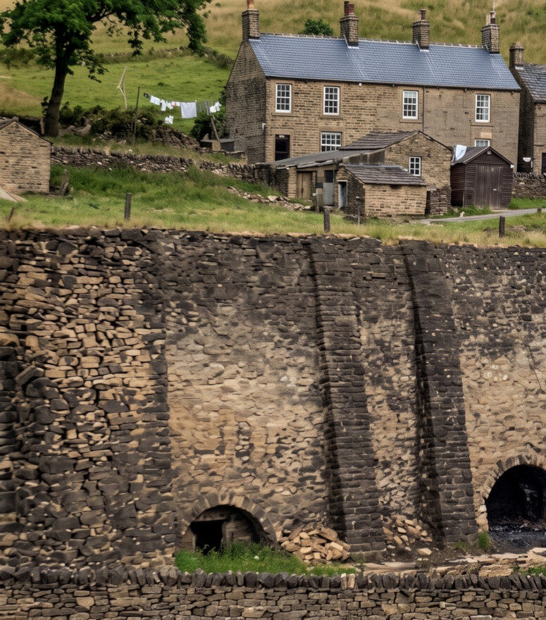
The heavy stone masonry walls surviving intact on site today. (Click to expand)
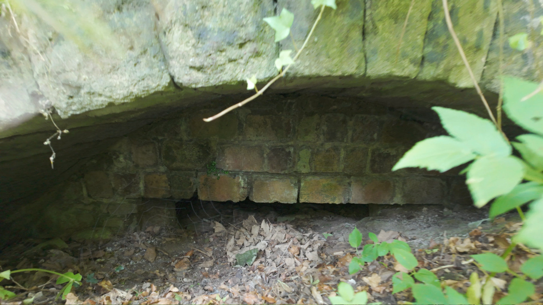
The fires finally went out around the outbreak of the Great War (1914–1918). Remarkably, the vast archaeological layout of this entire eight-kiln battery sits safely preserved right beneath the modern residential houses built over the high bank! If you look across towards Mr. Satterfield's Arm from the old trackway, you can find the original stone kiln faces peeking out behind the heavy trees. The historic drawing arch openings are still clearly visible today. See image above!
⏳ The Frozen Time Capsule Kiln
To build this massive battery, Victorian engineers completed a major feat of landscape modification—completely diverting the path of the Black Brook river into a straight, stone-lined bypass channel that still handles the valley's water today. Local lore tells us that when the site was abruptly abandoned, one final kiln shaft had just been thoroughly cleaned, repaired, and stacked to the brim with raw limestone and fresh coal—leaving behind a literal, untouched time capsule of the industry's dying day.